A recent FOI request by thestory.ie resulted in the release of a dataset of incidents on the M50 from 2020 to recently. This bolgpost outlines the data cleaning process, and production of a visualisation using Tableau.

A recent FOI request by thestory.ie resulted in the release of a dataset of incidents on the M50 from 2020 to recently. This bolgpost outlines the data cleaning process, and production of a visualisation using Tableau.
Remote Sensing Data, from Copernicus, is examined for its usefulness as a proxy for very detailed information on dwelling and commercial building location. Three specific data-sources - Corine Land Cover, European Settlement Map and Imperviousness - are assessed as to their value and suitability. Some details of processing of these datasets is then outlined.
What are we interested in?
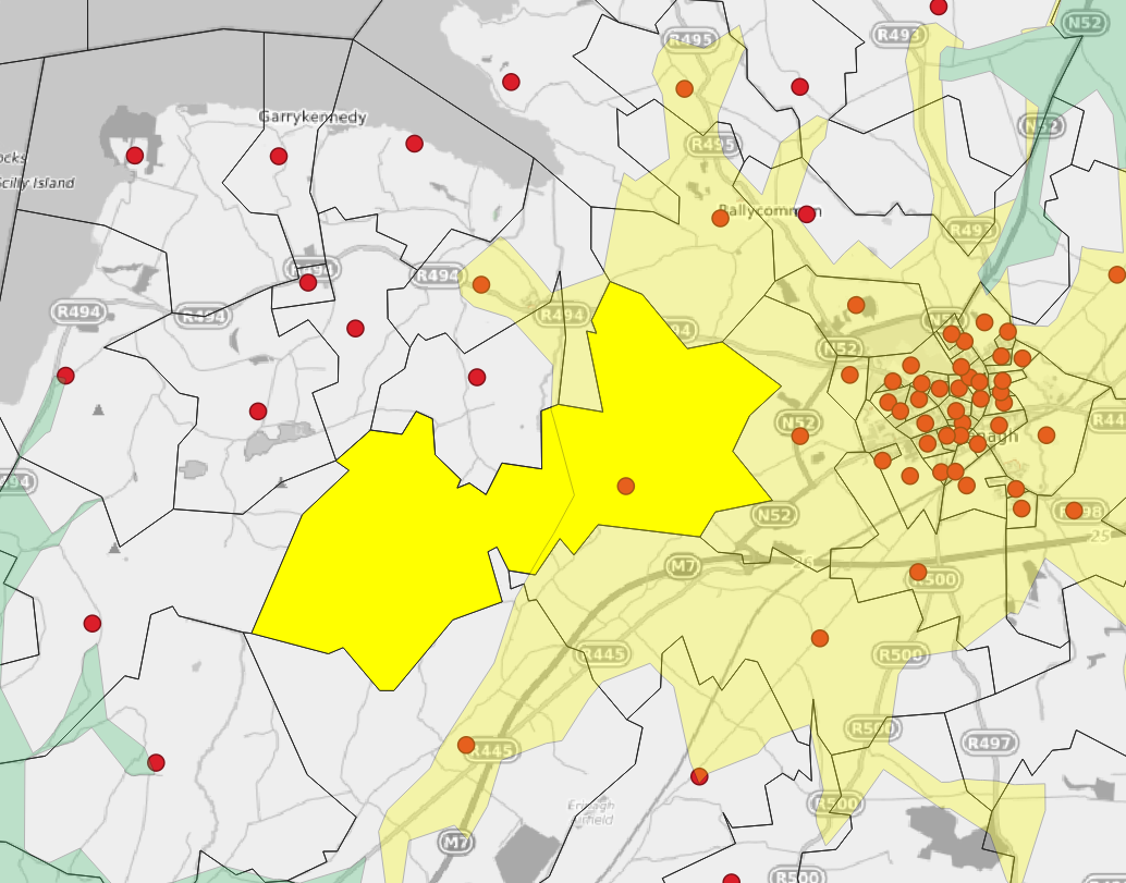
It is generally accepted that the faster a fire appliance can respond to a fire, the better the outcome with respect to rescues and property damage. So a key determinant might be the proportion of the population with the best possible fire service response.
Docker container for OpenRouteService is installed, with notes on the process, enabling local generation of time-travel boundaries.
Dataset of all Republic of Ireland Fire Stations, including callsign. Downloadable in geojson format.
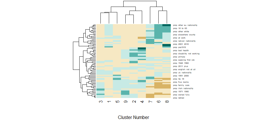
Exploratory Data Analysis of the Ireland Census 2016 Workplace Zones dataset, including a K-nearest neighbours clustering approach. R notebook and Tableau Visualisation included.
Examination of some of the evidence given during the Grenfell Tower Inquiry, with respect to Fire Safety Risk Assessment. Analysis of statements by one Risk Assessor around the likelihood of finding widespread defects in doorsets, based on random surveys.