Explore the range of services available from the Geospatial team at LINT…

Solar PV Panel Glint and Glare Assesments
LINT provide a full consultancy service for Solar Panel Glint and Glare Assesment. Contact us for more details or see here

Vehicle Fleet GPS Telemetry Analysis
Leverage your vehicle fleet GPS telemetry to explore potential routing and service area efficiencies - are your drivers and vans being used effectively? Contact us here for more details
Mapping

Event Planning
We can take all presentation formats (CAD, pdf, Imagery) and convert it into actionable spatial data, overlaying it with satellite imagery or other layers of interest.
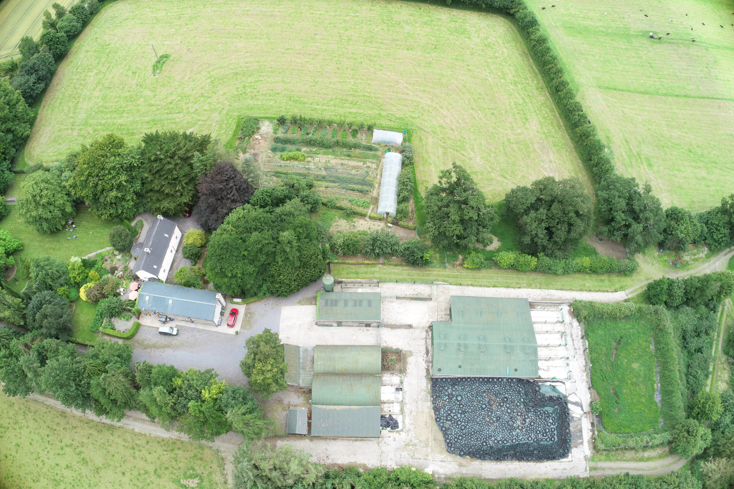
Drone Surveying
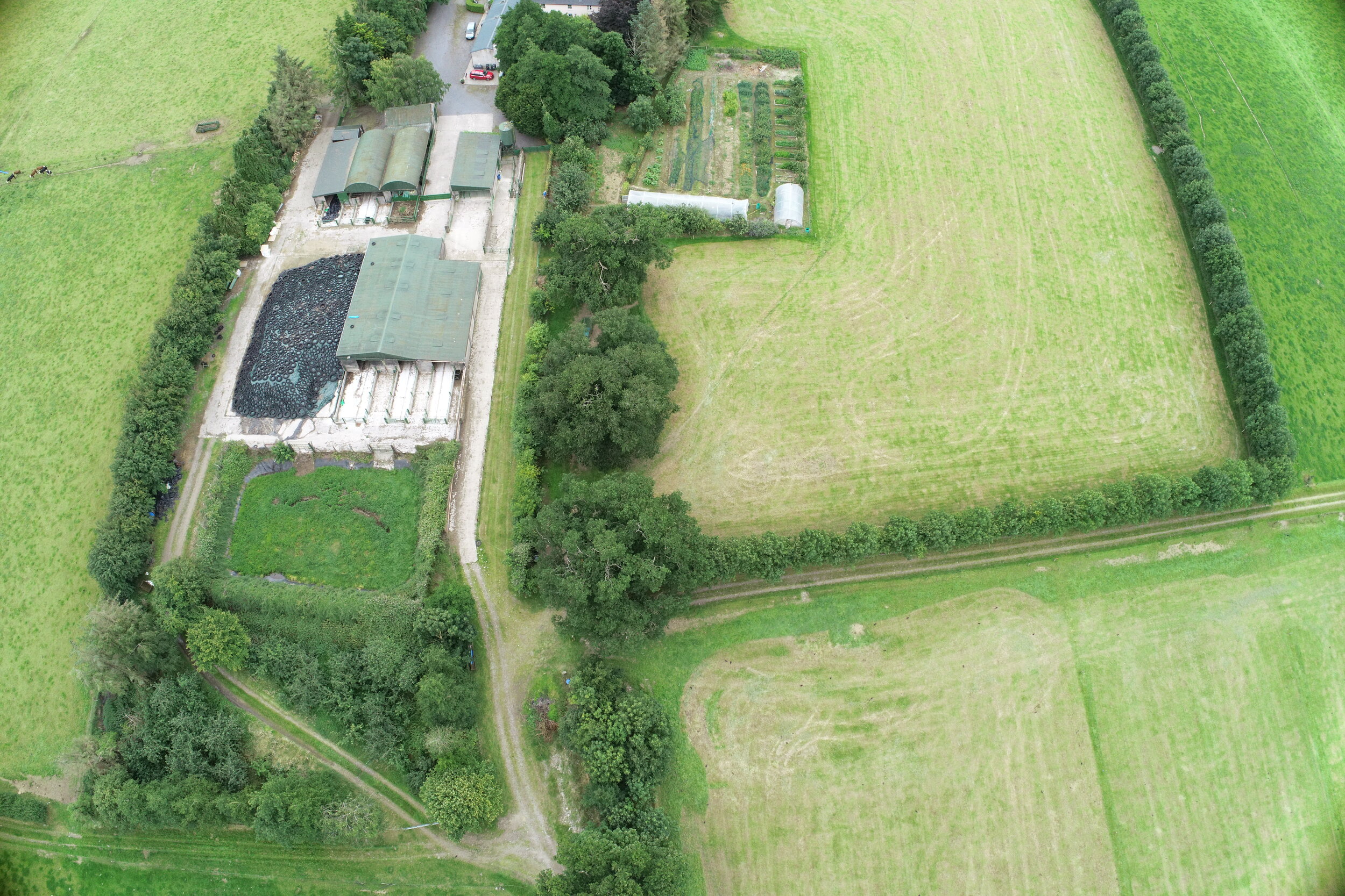
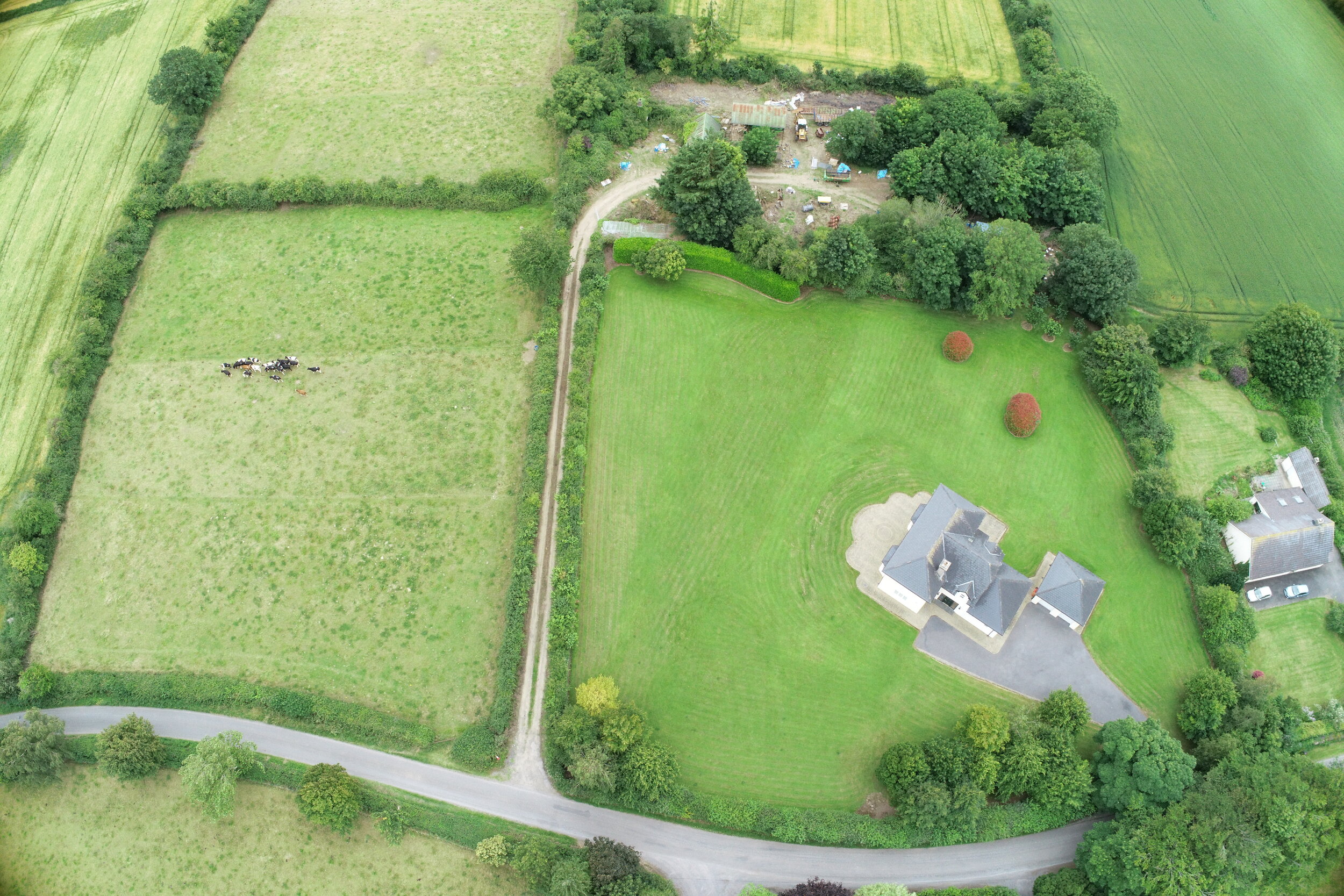
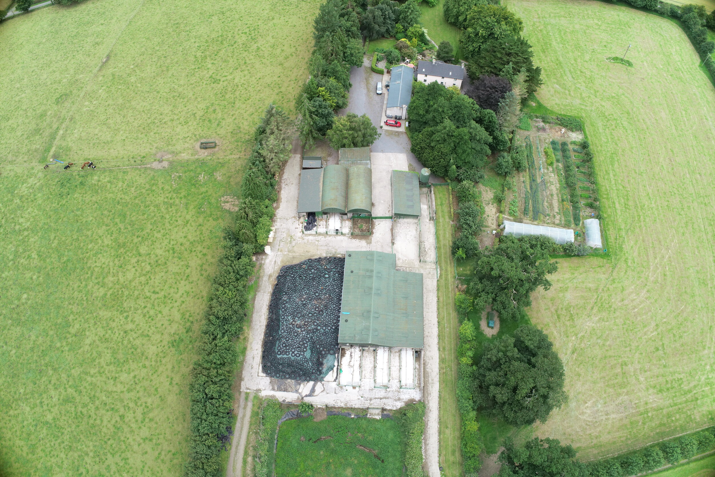
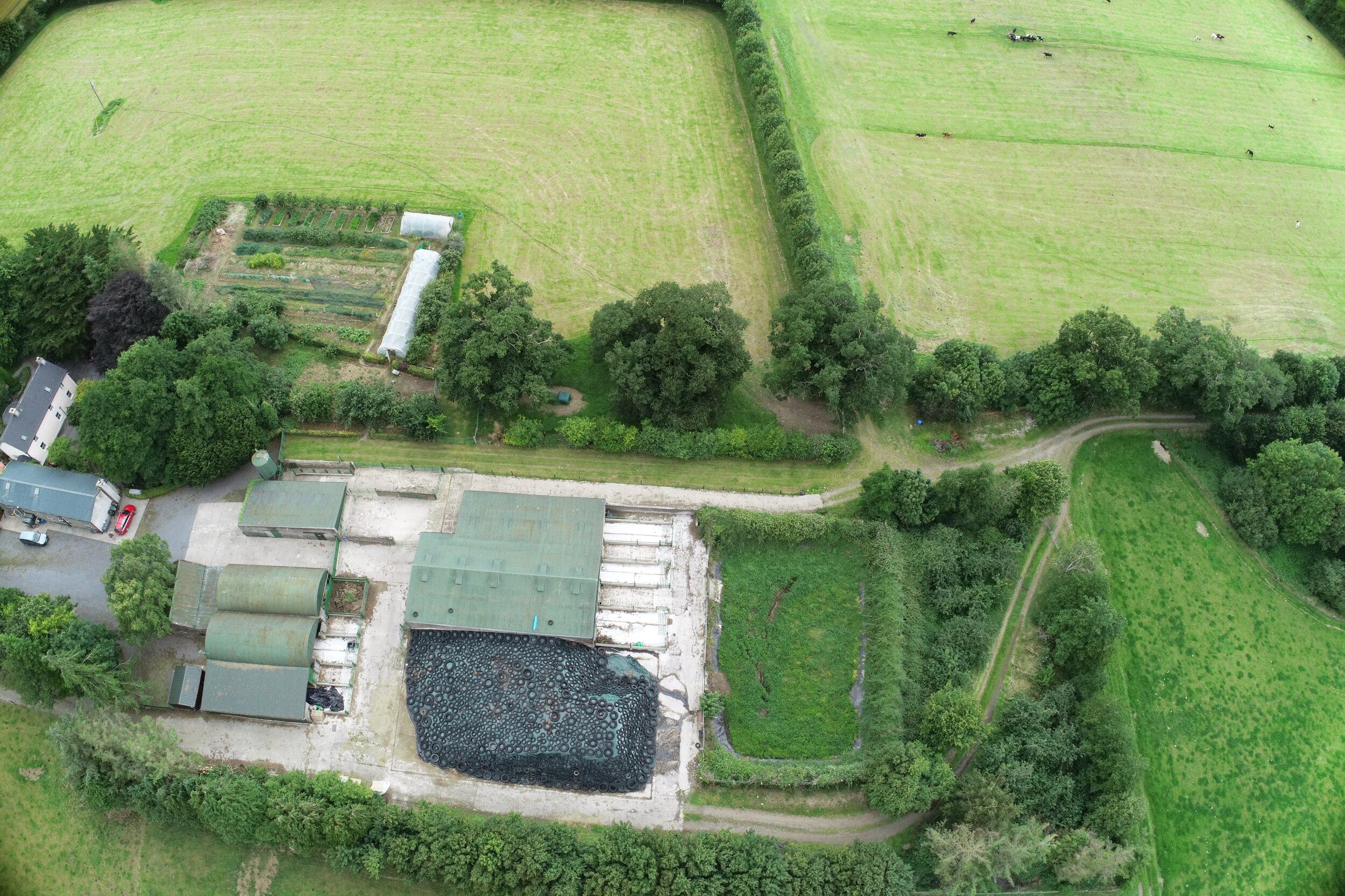
Drones have changed the way we view the world - literally! It is now a very straightforward process to construct a 3d model that is accurate to less than 2cm of any structure in less than half a day. Likewise, high-resolution orthographic imagery can be produced for large areas with the minimum of fuss. Contact us to find out more…
The images above and overview video below show the imagery captured by a short and unobstructive drone survey, converted via photogrammetry software into a high resolution three-dimensional model.
Applications include:
Property Sales
Pre-purchase Buiding Surveys
Refurbishments and Renovations - before and after
Boundary Surveys